

Gerard Galang | Geog 135 [Rural and Urban Geography] WFY Class
Contributors: Francine Aganon, Sam Dimaculangan, MC Florentin, Beverly Frades, Eldrich Jumamoy, Fiona Malaluan, Janna Maltu, Raymarc Marasigan, Liam Palanca, Jake Rom Cadag
Posted on June 2, 2026
Last February 15, our Geog 135 class went out into Metro Manila for the Geog Stops Field Activity. Instead of staying inside the classroom, we moved through the city itself using LRT Lines 1 and 2, the MRT-3, and several busways as part of our transect across some of the metropolis’ most complex urban spaces. The activity pushed us to observe the city the way geographers do: by asking how spaces are arranged, who uses them, and what the landscape reveals about urban life. From Antipolo to SM Mall of Asia and all the way to Old Manila, each stop gave us a different view of how geography shapes everyday movement, development, and experience.
Geog Stop 1: Lower Antipolo

The first stop, Lower Antipolo, introduced us to the transition from a dense urban setting to a place that still retains traces of a less compact landscape. We observed how the boundary between the city and the countryside becomes less distinct as urban expansion reaches the edges of Metro Manila. From the LRT Antipolo Station platform, we saw a striking contrast: one side opened toward the mountains, while the other faced commercial areas and residential subdivisions. That contrast made it clear that Antipolo is no longer just a peripheral green area, but a growing urban extension of the metropolis. The stop showed how development gradually reshapes the landscape and reduces the visibility of natural spaces.
Geog Stop 2: Araneta City and Cubao Area
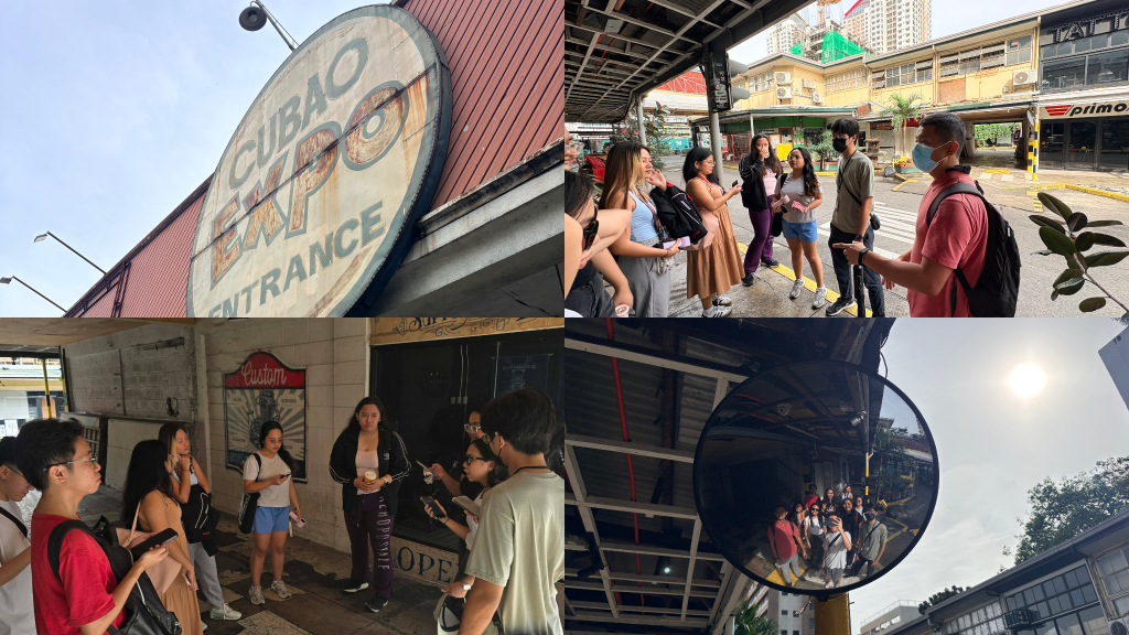
The second stop brought us to Cubao, particularly around Araneta Center and Cubao Expo, where the focus was wayfinding in an urban environment. The area was ideal for this activity because it combines pedestrian movement, transit connections, and commercial spaces that people have to navigate through signs, landmarks, and spatial cues. Since we were not allowed to use maps, we had to rely on our own sense of direction and on the built environment around us. We found the area manageable because some of us were already familiar with it, but the exercise also revealed how confusing it can be for people who are new to the place. Clear wayfinding depends not only on distance, but also on visibility, familiarity, and the overall design of the space.
Geog Stop 3: Recto and Binondo Area
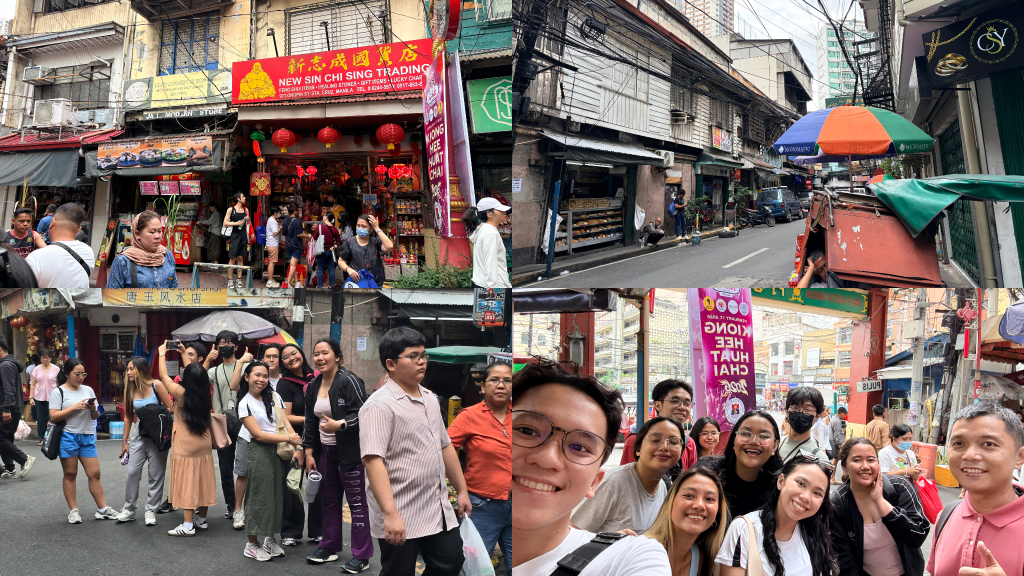
The third stop, Recto and Binondo, gave us one of the clearest examples of an organic urban landscape. Binondo has developed over centuries as a center of Filipino-Chinese culture and commerce, and it remains a strong example of mixed land use, where residential, commercial, and religious spaces exist close together. As we moved closer to Manila, the scenery became denser and more compressed. In Recto, we passed through tightly packed informal settlements, and the walk toward Carriedo and Binondo made the urban congestion even more obvious. The streets were narrow, busy, and full of sound, scent, and movement. Visiting during the Chinese New Year period added to the atmosphere, with red decorations, lucky charms, fruits, and fireworks filling the area with festive energy. What stood out most was how everything seemed to coexist in such a small space. Binondo reminded us that urban geography is not only about buildings and roads, but also about culture, history, and daily survival.
Geog Stop 4: SM North and Balintawak Area
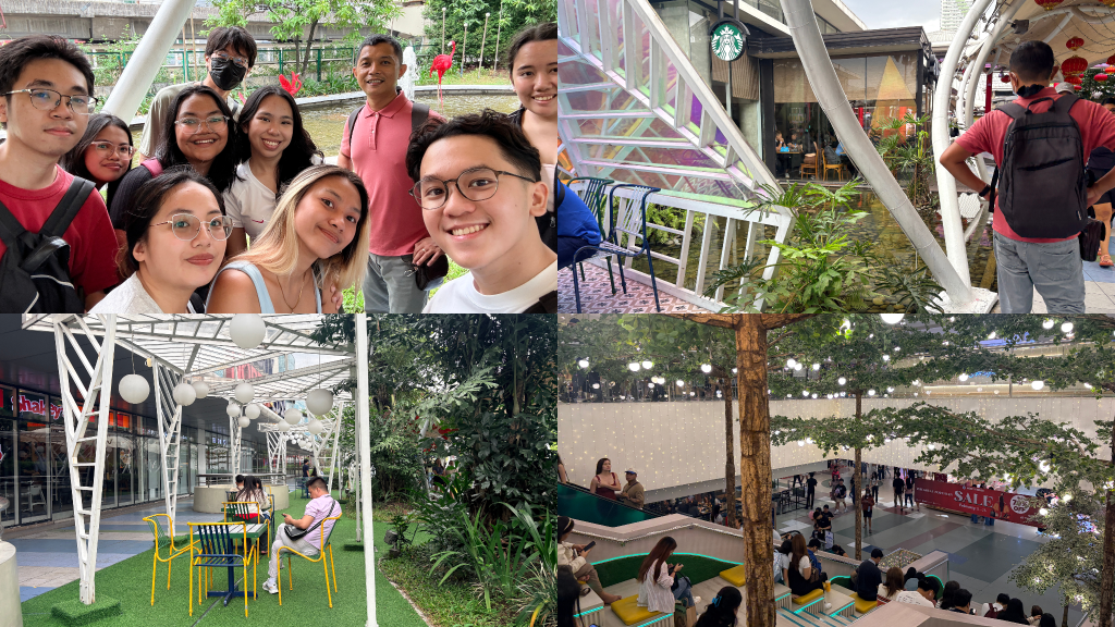
The fourth stop was the SM North and Balintawak area, where we studied Sky Garden as a green space within a highly commercial environment. We chose the site because it reflects the relationship between nature and society in the city. Sky Garden was intended to serve as a relief space in a dense urban setting and as a response to the lack of open green areas in Metro Manila. However, while the space looked visually green, it did not fully function like a genuine urban park. Traffic noise remained noticeable, the area was crowded, and parts of the space felt more focused on appearance than on safety or environmental function. The stop made us realize that a space can be designed to look natural without fully serving the purpose of a true public green space.
Geog Stop 5: Makati and Ortigas Area
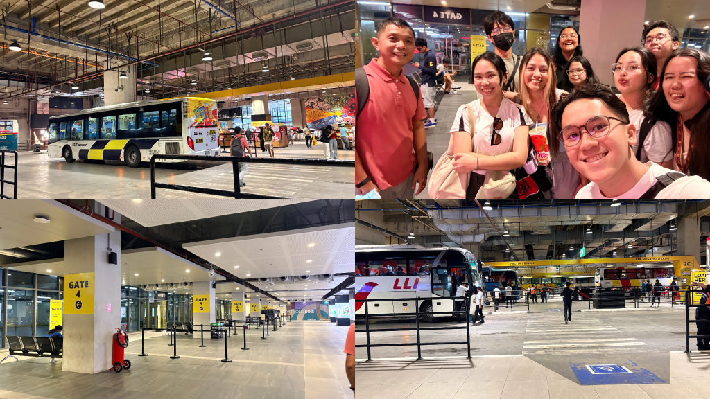
The fifth stop focused on a major transportation hub in Makati or Ortigas, where we observed how public utility vehicles and transit systems organize movement in the city. This site was important because it serves as a convergence point for commuters from different places and backgrounds. Moving from SM North to MRT-3 North Avenue Station was physically demanding because of ongoing construction, broken escalators, and long elevator queues. After riding the MRT to Ayala Station, we entered One Ayala, a large multi-modal transport hub. At first, the layout was unfamiliar, but it allowed us to look more carefully at how the facility was designed. Different transport modes were separated into different levels, helping reduce congestion and improve flow. The stop showed that transportation infrastructure is not just about movement, but also about the spatial organization of people and vehicles in a crowded city.
Geog Stop 6: SM MOA and Pasay Area
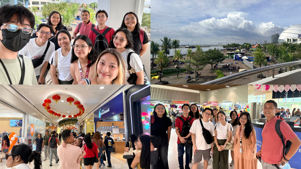
The sixth stop was SM Mall of Asia and the Pasay area, where we observed coastal urban development and land reclamation. The site is one of the largest mixed-use commercial developments in the country, and it shows how cities expand beyond their original natural boundaries. Walking through the area, we observed the flow of people, the kinds of establishments present, and the larger urban features around the site. We also saw the Horizon Manila reclamation project, where dredged sand and layered construction were visible along the bay. This raised important questions about the environmental and social effects of reclamation, especially for nearby communities. At the same time, the stop showed that the area functions not only as a commercial zone, but also as a place for leisure, recreation, and social gathering.
Geog Stop 7: Old City Manila Area
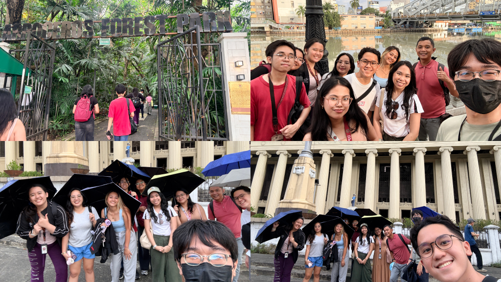
The final stop took us to Old City Manila, where we visited Arroceros Forest Park, the Manila Central Post Office, and the Pasig Esplanade. This stop highlighted the contrast between remaining green spaces and the pressures of urban congestion. Arroceros Forest Park felt calm despite being in the middle of the city, but it also reminded us how natural habitats continue to be replaced by more built-up areas. The abandoned Manila Central Post Office added another layer to the experience, as it showed the decline of an important historical landmark. By the time we reached the Pasig Esplanade, the rain had started, making the walk more difficult. We also discussed the proposed Pasig River Expressway and its possible effects on the city. The final stop brought together many of the themes we encountered throughout the activity: congestion, heritage loss, environmental decline, and the challenge of building a more livable urban Manila.
Key Takeaways after the Field Activity
The Geog 135 Field Activity gave us a clearer understanding of how geography is experienced in everyday urban life. Moving across different parts of Metro Manila showed us that cities are not fixed or uniform. Instead, they are shaped by constant movement, development, and human activity. From the expanding edges of Antipolo to the dense streets of Binondo, we saw how urbanization transforms both natural and built environments.
We also realized how infrastructure plays a major role in shaping how people move and interact with the city. Transportation systems, walkways, and transit hubs can either make movement easier or more difficult depending on how they are designed. At the same time, places such as parks, coastal areas, and riverfront spaces reminded us of the need to balance development with environmental and social needs.
Another important takeaway is that urban spaces reflect both opportunity and inequality. Some areas are highly developed and organized, while others continue to struggle with congestion, lack of space, and limited resources. Overall, the activity showed us that geography is not only a subject discussed in class, but something we encounter daily in the way we experience and navigate the city.
The author is a student of Geog 135 (Rural and Urban Geography) WFY class.