

Paul Benedict A. Talatala | Geography 131 [Geography of the Philippines] WFU Class
Posted on April 22, 2026
“Holistic” is a word that scholars of geography are all too familiar with.
Geography’s scientific vision is one that aims to study the Earth’s surface and the human-environment interactions that affect it through a spatial perspective. This requires us, the scholars of geography, to be familiar with almost every single aspect (geological, social, cultural, historical, etc.) of a certain space on Earth’s surface and how it functions as a unified whole.
And for our AFA last October 25-26, those surfaces on Earth were Bataan and Zambales.

When I was first tapped to become the head for academic affairs of UP GeogSoc’s flagship program, GeogRide, the key organizing body of the AFA, I was ecstatic. The opportunity to scout for the places where we could learn the most about the history, cultures, and uniqueness of the Philippines and to help curate meaningful learning experiences for my fellow geography majors was an opportunity I eagerly accepted.
Eventually, we decided upon three main places: the Dambana ng Kagitingan in Pilar, the quiet coastal town of Candelaria, and the Museo ni Ramon Magsaysay in Castillejos.

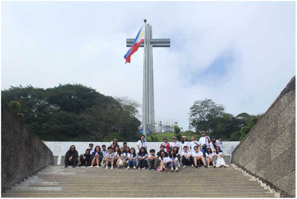
The Dambana ng Kagitingan was our first stop for the field trip. Standing before the towering memorial cross on Mount Samat, we were greeted by a sweeping view of the Bataan Peninsula with Manila Bay to the East and the West Philippine Sea to the West. Our tour guide recounted the brutal realities of the Japanese invasion, the Fall of Bataan, and the Filipino-American resistance that took place on the literal ground that we were standing on. The narratives of war intertwined with the Mountain’s geography. Seeing firsthand its elevation that offered a strategic vantage point over the peninsula, the sides of the mountain that sheltered the soldiers, and the plains where the battles unfolded gave us a newfound appreciation for the sacrifices of our countrymen.

But the AFA was never meant to solely revolve around just human geography. As we traveled northward towards Zambales, the journey became a moving lesson in physical geography from our bus seats. We passed through the Central Luzon Plains and emphasized its importance as one of the country’s most productive agricultural regions and observed the solitary Mount Arayat as a unique feature in the region’s physical landscape.
Further ahead in the route we sighted the lush Zambales Mountains which contains the largest ophiolite complex in the Philippines. We also went past various lahar rivers such as the Santo Tomas and Bucao Rivers that were born from the 1991 Pinatubo eruption as well as the historical Iba Airport which was bombed by Japanese forces on the same day as Pearl Harbor. We also passed through the municipality of Masinloc where just beyond its horizon lies Bajo de Masinloc (Scarborough Shoal), one of the most geopolitically contested atolls in the world due to China’s illegitimate 10 dash line claim.


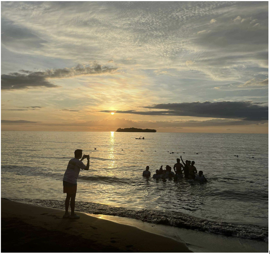
Eventually, we arrived at Candelaria after spending almost half the day travelling. We were greeted with a welcoming cultural performance by local high school students of Candelaria. At our accommodation, the waters of the West Philippine Sea stretched endlessly before our eyes, with the island of Potipot in the foreground. There, we spent the rest of the day swimming along the shore, participating in educational games, and bonding with fellow field-mates until we were able to witness the majestic sunset view that Candelaria, as well as the entire west coast of Zambales, is known for.

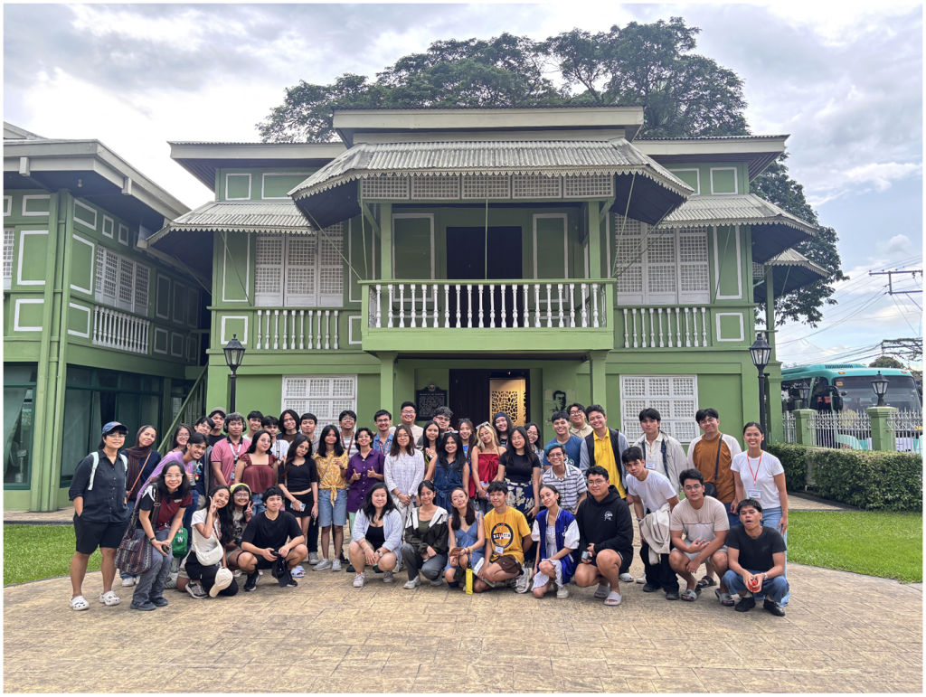
On the second day of the trip, we went to the Museo ni Ramon Magsaysay in Castillejos, the ancestral home of the Philippines’ seventh president. We learned about his personal life, achievements, and enduring legacy as the “Champion of the Masses.” However, we also reflected on the more controversial aspects of his policies such as those he made as Secretary of National Defense under President Elpidio Quirino, notably, his military suppression and antagonization of the Hukbalahap. His campaign effectively delegitimized peasant resistance by labeling it as communist subversion of the state. This also coincided with his homesteading acts that encouraged large-scale migration to the island of Mindanao. When we view this through a geographical lens, we see the narratives of settler colonialism and resource exploitation that continue to define the struggles Mindanaoans experience up to this day.
After we toured the museum, it was finally time for us to go to our respective homes.
Personally, this was one of the most enriching AFA experiences I’ve had in UP. It brought me face-to-face with the realities I’ve only encountered through readings and classroom lectures: mountains transformed by war, beaches shaped by geopolitics, and rivers formed by volcanism.
It was an experience that truly brought about the holistic approach of geography.
I am deeply grateful to UP GeogSoc, to the faculty who supported us and endorsed this AFA to their classes, namely Ma’am Darlene Gutierrez, Ma’am Dominique Sasha Amorsolo, and Mx. Arra Camille Canare, and especially to Janna Louise Lagman, the head organizer of GeogRide whose dedication and leadership made this entire experience possible.
Here’s to more GeogRides in the future. For more opportunities for learning outside the walls of the classroom and on the surfaces of the earth that we, as geographers, devote ourselves to understanding.
Paul Benedict A. Talatala is a second-year BS Geography student at the University of the Philippine-Diliman. He is currently taking Geography 131 under Ma’am Darlene Gutierrez. He is also the Deputy for Academics and Research Committee of the Geographic Society of the University of the Philippines (UP GeogSoc), and the UP GeogSoc’s GeogRide Academic Head.